Satellite Analytics to Drive the Green City Revolution
Challenges
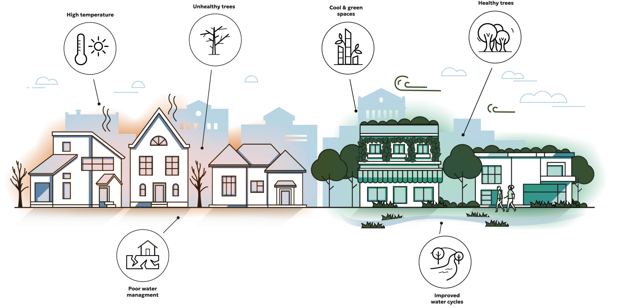
Cities everywhere are striving towards the green revolution that is needed to adapt to climate change and make our cities the healthy livable places we want to be.
But to achieve this step change in city greening, new datasets are needed to help city planners, arborists and developers highlight problem areas, identify where policies are working and monitor progress towards targets.
Unfortunately, remote sensing from aerial imagery or drones is too expensive to be regularly updated and much satellite imagery is too low in resolution.
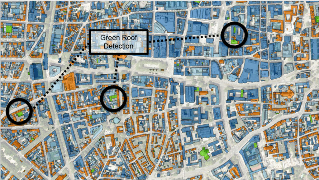
Our Solutions
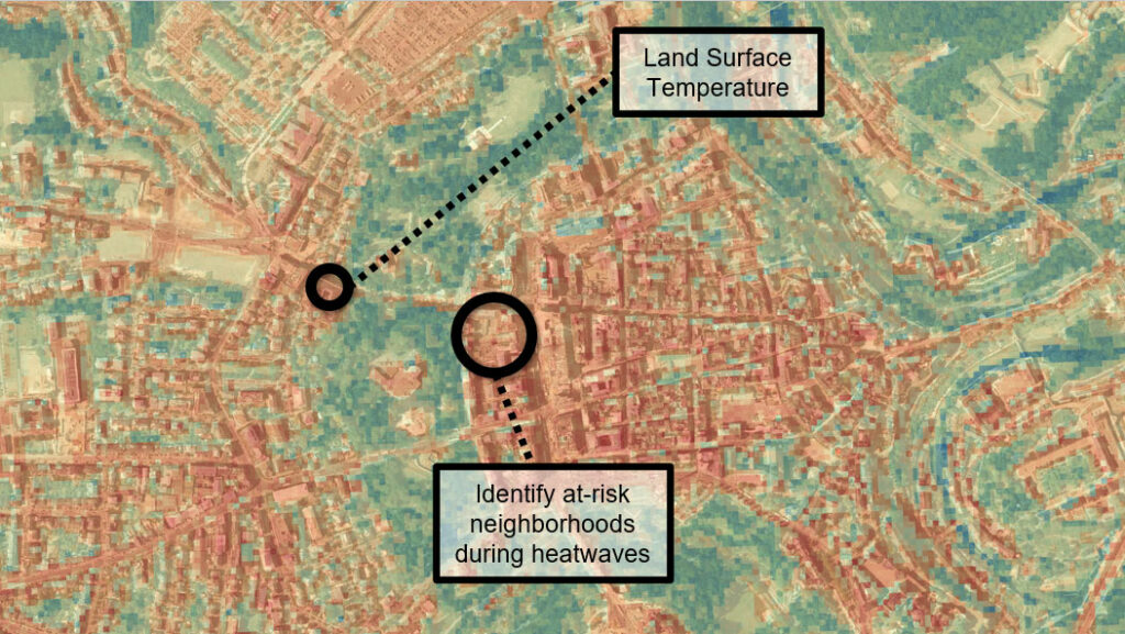
Identify urban heat islands through high resolution surface temperature monitoring.
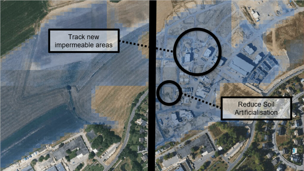
Track surface sealing to encourage biodiversity and reduce rainfall runoff that increases flood risk.
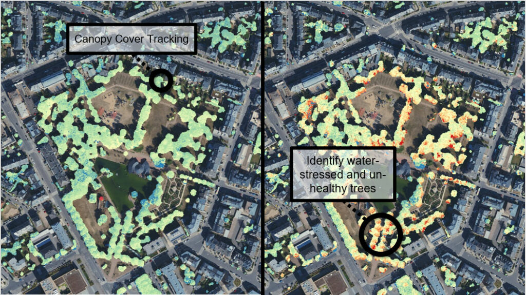
Measure the growth and health of trees to help grow urban forests.
Identify urban heat islands through high resolution surface temperature monitoring.
What We Offer
Trustworthy
WEO have built long-term relationships with our clients because we deliver in a timely fashion and are upfront about what our data can be used for
Actionable Insights
Identify sick trees before its too late.
Pinpoint and rectify urban heat islands.
Analysis that makes building resilient cities easier.
Affordable
Our satellite-driven analytics are a fraction of the cost of laser scanning, drones or aerial surveillance
Regular Updates
WEO use frequently updated satellite data to provide updated analytics to your desktop on a seasonal or annual basis
High Resolution
Our machine learning techniques take lower resolution satellite imagery and extract high resolution insights
Widespread Coverage
The base of our maps is globally-available satellite data. Combined with our locally-trained algorithms, we can provide accurate data across cities or countries.
Case Studies
Sealed Surface Mapping
WEO was engaged to analyse surface sealing for a major Belgian city. Our 1m resolution maps are used to understand better how to slow sealing and the impact of new surfaces such as artificial turf and permeable pavements.